36 items have been found that match your search request.
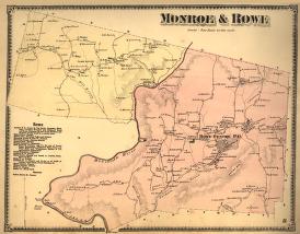 |
"Monroe & Rowe"
1871
L02.002
The 1871 map of these two northern towns in Franklin County, Massachusetts, shows that, despite a small number of inhabitants, Rowe maintained a small-scale industrial base, while Monroe was too sparsely populated and far from transportation routes to do so. |
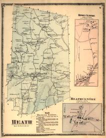 |
"Heath"
1871
L02.003
Heath in 1871 was a highly agricultural town with even less manufacturing facilities than its neighbors. |
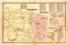 |
"Coleraine/Leyden"
1871
L02.004
The northern Massachusetts towns of Coleraine (now Colrain) and Leyden were interesting contrasts in 1871. While Coleraine was able to support several small industries, Leyden was in the midst of a long decline and had become almost entirely agricultural. |
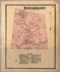 |
"Bernardston"
1871
L02.005
The town of Bernardston shows its mostly rural character in this map from the 1871 Beers "Atlas of Franklin County, Massachusetts." |
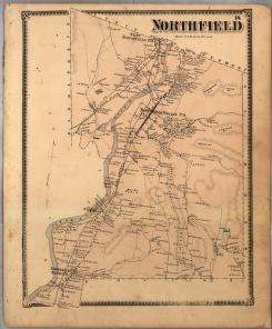 |
"Northfield"
1871
L02.006
In this map from the 1871 Beers "Atlas of Franklin County (Massachusetts)," the town of Northfield, the area's second-longest settled town, shows the same population settlement pattern that holds today, with most of the town living near the Connecticut River. |
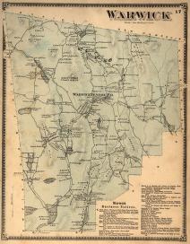 |
"Warwick"
1871
L02.007
Warwick in 1871 was still healthy compared to its 1820 height, but fifty years of economic and population decline would nearly cause the town to disappear from the map. |
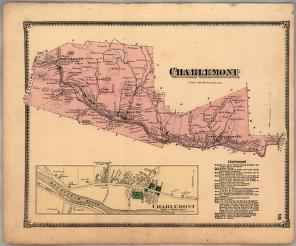 |
"Charlemont"
1871
L02.008
The town of Charlemont in 1871 was still hoping that the long-promised Hoosac Tunnel would be completed. It would soon get its wish in 1875. |
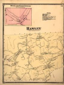 |
"Hawley"
1871
L02.009
Hawley in 1871 was one of the most lightly populated towns in the Commonwealth of Massachusetts. This map depicts the few homesteads spread through Hawley's ruggedly picturesque hills. |
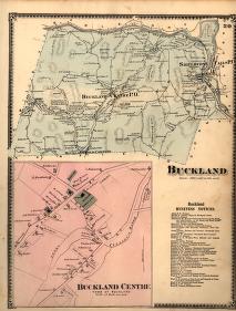 |
"Buckland"
1871
L02.010
Buckland in 1871 had already begun to grow in the corner of the town on the Deerfield River and across from Shelburne Falls. The rest of the town remained remotely rural. |
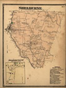 |
"Shelburne"
1871
L02.011
This map of the town of Shelburne, Massachusetts, is taken from an atlas created by Frederick W. Beers, referred to as the Beers Atlas, published in 1871 |


