Charlemont, Massachusetts
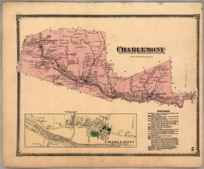
The town of Charlemont in western Massachusetts lies to the north of the Deerfield River, on the scenic road called the Mohawk Trail. The town is largely hill country, with some rich farm lands along the river. In 1735, the land that would become Charlemont was included in Boston Township No. 1, which was created to grant Boston's petition for additional land. English settlement of the township was slowed by King George's War in the 1740s and by its location on the front line between English and French America. The British built a chain of forts on its northern edge to protect the township, fortifications that were tested during the French and Indian War (1754-1763). The first meeting house was built in 1753, and in 1765 the township's southern half was incorporated as Charlemont. In 1779, the town of Buckland split off from Charlemont and in 1785 the town lost its northern third to the newly formed towns of Heath and Rowe. Charlemont's economy was largely agricultural, though in the 1800s it also benefited from some small-scale mining and from the Troy and Greenfield Railroad, which carried products of its small industries to market. In the 1900s, Charlemont's major industry shifted to tourism as it capitalized on its scenic terrain and its location on the Mohawk Trail.